


Voting District 0400048, Suffolk County, New York
About
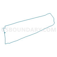
Outline

Summary
| Unique Area Identifier | 636858 |
| Name | Voting District 0400048 |
| County | Suffolk County |
| State | New York |
| Area (square miles) | 0.94 |
| Land Area (square miles) | 0.94 |
| Water Area (square miles) | 0.00 |
| % of Land Area | 100.00 |
| % of Water Area | 0.00 |
| Latitude of the Internal Point | 40.82161220 |
| Longtitude of the Internal Point | -73.43321580 |
Maps


Graphs
Select a template below for downloading or customizing gragh for Voting District 0400048, Suffolk County, New York


Neighbors
Neighoring Voting District (by Name) Neighboring Voting District on the Map
- Voting District 0400022, Suffolk County, NY
- Voting District 0400027, Suffolk County, NY
- Voting District 0400033, Suffolk County, NY
- Voting District 0400059, Suffolk County, NY
- Voting District 0400061, Suffolk County, NY
- Voting District 0400062, Suffolk County, NY
- Voting District 0400079, Suffolk County, NY
- Voting District 0400143, Suffolk County, NY
- Voting District 0400162, Suffolk County, NY
Top 10 Neighboring County Subdivision (by Population) Neighboring County Subdivision on the Map
Top 10 Neighboring Place (by Population) Neighboring Place on the Map
Top 10 Neighboring Unified School District (by Population) Neighboring Unified School District on the Map
Top 10 Neighboring State Legislative District Lower Chamber (by Population) Neighboring State Legislative District Lower Chamber on the Map
Top 10 Neighboring State Legislative District Upper Chamber (by Population) Neighboring State Legislative District Upper Chamber on the Map
Top 10 Neighboring 111th Congressional District (by Population) Neighboring 111th Congressional District on the Map
Top 10 Neighboring Census Tract (by Population) Neighboring Census Tract on the Map
- Census Tract 1111, Suffolk County, NY (8,853)
- Census Tract 1119, Suffolk County, NY (5,592)
- Census Tract 1120.01, Suffolk County, NY (4,456)